Documenting a Build by Drone: A Year at Tana Beru From Above
Drone documentation has become the most useful reporting tool for phinisi builds at Tana Beru: a monthly aerial pass over the yard records hull progress, timber stocks, and workmanship context in a way ground photographs cannot. Over a full build year the archive shows the keel appearing in the sand, frames rising, planking closing, and finally the hull’s track to the sea — an objective visual ledger that supports milestone payments, remote quality reviews, and, at the end, a film of your ship being born on a beach.
Why Aerial Beats Ground-Level for Build Reporting
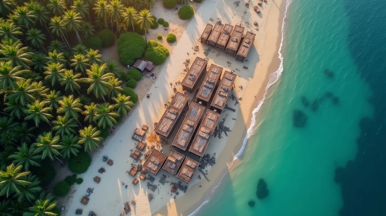
A phinisi hull is bigger than the photographs make it. From the sand, a 30-metre vessel on blocks fills the frame and hides its own geometry; from sixty metres up, the keel line, the symmetry of the frames, and the run of the planking read at a glance. An aerial sequence taken from the same waypoints each month becomes a comparable series — the same hull, same angles, thirty days apart — which is exactly what a remote owner needs to verify that a payment milestone described in the contract exists in the sand. We fold these passes into the monthly reporting cycle described on our custom phinisi construction page.
The drone also documents context that matters commercially: how much seasoned timber is stacked beside your build, how many other hulls share the yard’s attention, whether the cradle and skid track for launching are being prepared on schedule. None of this is visible in a close-up of a plank seam.
A Year at Tana Beru From Above
Month one shows almost nothing — a cleared patch of beach, blocks, and the keel timbers arriving, the quiet stage we describe in our keel-laying piece. By month three or four, frames stand like whale ribs and the hull’s full length is legible for the first time. The long middle of the year is planking: each pass shows the dark band of closed hull creeping upward, strake by strake. Then the deck beams cross the hull, the superstructure blocks in, and the aerial frame starts to include the growing scar of the launch track down to the tide line. The final sequence — hundreds of villagers on the ropes at the launching — is the one owners replay for years.
Flown consistently, the archive doubles as a build-duration record. Weather pauses, timber deliveries, and crew surges are all visible, which keeps schedule conversations factual; the typical rhythm is laid out in our keel-to-launch timeline.
There is an archival dividend, too. Tana Beru’s beachscape is itself a document — dozens of hulls at every stage, timber stacks, launch tracks, the whole anatomy of a working heritage coast in one frame. Owners who commission a year of flights end up holding not just their boat’s biography but a rare longitudinal record of the craft itself, the kind of material museums and documentary makers ask after. Several clients have donated edited sequences back to the yards for exactly that purpose, which the building families receive warmly: the craft has always been proud of being seen doing things properly.
Etiquette, Permissions, and Local Rules
The beach is a workplace and a village, not a film set. Drone flights happen with the yard’s permission and the builder’s knowledge — arranged in advance, flown at hours that do not put a machine over workers’ heads, and grounded entirely on ceremony days unless the family explicitly invites filming. Ritual moments such as the navel ceremony are private unless offered. Indonesian drone regulations also apply: registration, altitude limits, and no-fly conditions are the operator’s responsibility, which is one reason we use established local pilots rather than asking clients to bring equipment. Guidance for visiting a working yard respectfully is in our visitor’s guide to Tana Beru.
What We Deliver to Commissioning Clients
For managed builds we deliver a monthly package: fixed-waypoint aerial series, ground-level detail photographs keyed to the inspection checklist, and short video passes of any stage transition — keel, first strake, deck closing, launch preparation. The material is archived for the life of the project and cut into a launch film at handover. It serves three audiences at once: the owner tracking milestones, the surveyor preparing the next quality inspection, and — for charter owners — the future marketing of a vessel whose build story is an asset. Boats entering service with our sister brand Komodo Luxury’s construction programme carry exactly this kind of documented provenance.
Can I fly my own drone at the yards?
Ask first, always — through your yard host, before you travel. Most builders are relaxed about progress filming of your own hull and firm about ceremony days and other clients’ vessels. Indonesian registration and altitude rules apply to visitors’ equipment.
How often should a build be documented?
Monthly is the useful cadence: frequent enough to verify milestones and catch drift, spaced enough that each pass shows real change. We add extra passes around stage transitions and launching.
Is aerial footage accepted as milestone evidence?
Yes, in combination with ground photographs and the inspection record. The fixed-waypoint series makes progress comparisons objective, which is precisely what a staged-payment contract needs.
Do I get the footage rights?
For managed builds, yes — the archive is delivered to the owner at handover, including raw files. Yards generally ask only that footage showing neighbouring builds be used with courtesy.
Want your build documented from the first keel block to the launch ropes? Message us on WhatsApp at +62 811-3941-4563 or write to bd@juaraholding.com and we will set up the reporting programme with the yard — or start the conversation through our contact page.